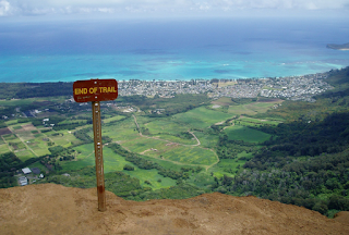
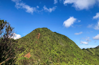
Posts

Maunawili Loop

Image
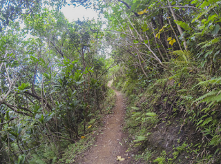
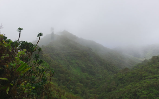
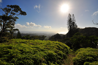
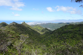
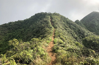
Maunawili demonstration trail The Missus and I went on a hike in Maunawili on Friday morning (8 May 2005), she being off that a.m. and me having (almost, save for a pile of research papers to be graded) finished the spring semester at LCC. We started at the Maunawili Falls trailhead after parking on Kelewina Street. Shoved off around 10:20 a.m. Nice warm day. Blue skies. Very dry trail. Hiking with Jacque is always an experience because she has an interesting way of looking at things. For instance, as we were hiking along today, she tells me things like, "This place reminds of Shirley Temple singing the song about blue robins" or "I'm expecting to see trolls and ogres somewhere around here." I smile hearing these things because they are so unlike the kinds of thoughts I have. She also loves colorful flowers, of which there was an abundance that day, all from non-natives like impatiens, African tulips, et al. So we hiked along, Jacque occasionally expres

Kipapa trail

Image
On 4 August 2005, I did a long hike for the first time in a long time and survived. Good news.  A bunch of us showed up yesterday to help work on the Kipapa Trail at the request of Nancy Hoffman from U.S. Fish and Wildlife. Let me see, who was there? my wife Jacque, Scott Villiger, Bart Mathias, John Hall, Bill Gorst, Charlotte Yamane, and Mike Fujita. We chatted about, among other things, some HTMC members' philosophical protests about working on Kipapa.  Had a chance to take my wife's Honda CRV off-road for the first time. It was cool driving up the dirt road to the trailhead from Ka Uka Blvd.  Before we shoved off to start work, Nancy told us that the first three miles of the trail were in good shape. The remainder had become overgrown and needed work. Plus, she wanted some of us to hike up to inspect a landslide that had swept over the trail near the summit.  We started up the trail at 9am. Jacque, Scott, Bart, and I said we would head for the top to check on the l

Mokauea -- Kapalama

Image
After spending most of the day lounging around at home (I'm on vacation), I decided a workout hike was in order to balance the calorie consumption/burn scale somewhat. Yesterday, my buddy Bill Melemai and I spent a couple of hours in the late afternoon doing some saw and machete work on the Kapalama Loop Trail. We also ran into some access problems with Kamehameha security afterward, of which I won't elaborate except to say all ended well after a confusing interrogation. Anyway, wanting to continue to do some work on that same trail but looking to avoid hassles, I figured I'd try a different access route than through Kamehameha Schools. About a year ago, Mae Moriwaki mentioned hiking with friends on a route that started at DeCorte Playground, a small community park on Perry Street in lower Kalihi Valley. Behind DeCorte is a ridge that eventually intersects with the main Kapalama Ridge that continues all the way to Lanihuli and also which the Kapalama Loop trail is situ

Kapalama Loop

Image
My hiking buddy Bill Melemai and I completed an afternoon jaunt of the Kapalama Loop trail on a recent May afternoon. The traihead can be accessed by driving to the highest part of the Kamehameha Schools or via the top of Alewa Drive. Since Bill and I are alums of KS and can get on campus without being questioned, we start from the former. We meet at just past 3pm in the parking lot above one of the dorms and begin hiking at 3:20. We have hiked the loop several times in the past and the traverse time has usually been 2.5 hours, give or take. That being the case, I figure we will be pau by 6. We follow a chained-off gravel road for about a 100 yards and then veer left on a trail through a forest of mostly ironwoods. Twenty yards to the right (Diamond Head direction) of the trail is a new paved access road built by KS. This road extends upslope for a quarter mile and ends abrubtly at a turnaround circle. What the Kamehameha folks plan to do up in this area is a mystery to me (an

Wiliwilinui

Image
    At work on the Wednesday afternoon before Thanksgiving, Leslie Munro, one of my Leeward Community College colleagues, bid me a happy holiday and gleefully reminded me that most of us working folk would have the opportunity to sleep-in the next day. While Leslie and no doubt many others may have spent an extra hour or two in bed on Thanksgiving morning, I had something else planned: a hike up Wiliwilinui Ridge. In Stuart Ball's informative book about Oahu hiking trails, Wiliwilinui is listed among the two dozen or so "closed" hikes. In other words, access to these trails is either barred or so difficult to arrange that attempting to hike them would either involve trespassing or an act of God. Recently, however, a dispute between the residents' association of the Waialae 5 Subdivision and the Sierra Club regarding access to Wiliwilinui has hit the local news. The controversy led to the hammering out of an agreement so that mountain trekkers can now partake of W

Kuliouou Ridge

Image
If you have about three hours to spare and would like a chance to hike to the Koolau summit and back and be treated to world-class views, try the Kuliouou Ridge hike. The trail begins at the back of Kuliouou Valley, the one just town-side of Hawaii Kai. The hike begins with switchbacks, which--if you're in a hurry--can be avoided for the most part by taking a series of shortcuts up the ridge. If you opt for the shortcut route, be prepared for some heavy duty sweating and heavy breathing. I'd recommend against taking shortcuts, for doing so contributes to erosion--an ever-increasing problem on our trail system. Whatever route you choose, you can reach an eroded hill at the Koolau summit in an hour and a half with little difficulty. Absolutely wonderful views of the Waimanalo coast and of the coastline from Hawaii Kai to Diamond Head are your rewards. For the brave at heart, a half-mile ridge-walking balancing act to Pu'u O Kona can be attempted. To do thi

Mount Olympus

Image
I had hiked part-way up the trail to Mount Olympus early in 1995 but had turned back because I was alone and hadn't intended to head for the summit anyway. I did get my opportunity to stand atop this distinct peak when I joined 30 people on a Sierra Club- sponsored hike on April 28, 1996. The trail to Olympus begins in the Wa'ahila Ridge State Recreation Area above St. Louis Heights. At 8:40 a.m., led by hike leaders Bill Aoki and Bill Gorst, we shoved off for the 3.5 mile hike to summit. The first half of the trek followed along the Wa'ahila Ridge trail, a well-maintained path that rose and fell over several humps in the spine separating Manoa Valley to the northwest and Palolo Valley to the southeast. The group was an amiable one, with the more outgoing of us chatting about past hikes and pointing out the different types of vegetation along the route. The two Bills also did their jobs well, making sure we stopped every 20 to 30 minutes to catch our breaths and to swi